|
This hike was the highlight of the entire trip as far as I am concerned. This is sort of funny, because it wasn't part of the original plan. We had originally planned to do a cross-canyon hike, north to south, spend two nights on the south rim and then hike back. The closure of the North Kaibab trail put an end to this and so I came up with this hike as a backup plan. I wanted to try this trail for a number of years now after hearing a couple of rangers talk about their experiences on it. One ranger tells a fantastic tale of encountering a mountain lion along this trail early one morning while doing some advance scouting for his hiking party, the rest of which were camped at Cottonwood campground. He came across the lion shortly after it had just made a kill of a mule deer and was very lucky that the cat wanted the deer more than it was startled by him. I wanted to see a mountain lion as well and purposely started the hike early in hopes of that. No such luck,but we did get to see one of the rare, elusive and very shy Grand Canyon rattlesnakes.
This hike was originally planned to be 12 miles. It was revised, to Robin's dismay, to be 16 miles after talking with a ranger. It ended up being more like 18 miles, which is a bit much for a DAY hike. It's 4 miles from the North Kaibab trailhead, where you have to leave your car, along the Ken Patrick trail, to its junction with the Old Bright Angel. From there it's 7 miles, down the Old Bright Angel to its junction with the North Kaibab trail, at Roaring Springs. This ended up being more like 8 miles due to a couple of minor problems with the trail. We lost another mile or so at Roaring Springs trying to find the North Kaibab. We found a trail on the west side of Bright Angel Creek just below Roaring Springs and proceeded to follow that only to end up at the pumping station for the trans-canyon pipeline. We tried scouting around and climbing up because I knew the North Kaibab had to be around there somewhere but never found it. We ended up backtracking the trail we were on and this led us back to a junction that was the real North Kaibab trail. It was much higher up above the pumping station than I remember. They must have moved it... NOT! Once we were above the pumping station I could see that if we had just headed a little further north, through the brush along the creek, we would have come to the picnic area which is used by the one-day mule trips to Roaring Springs. From there you can take another spur trail up to the North Kaibab. Anyway, we're up to 13 or so miles and the hike up to the North Kaibab trailhead is another 5 which makes the total around 18. We started at 6:30 AM and finished around 7:00 PM.
The top section of the hike along the Ken Patrick trail was a very pleasant, early morning stroll. The trail wound it's way through forest and glades, sometimes near the rim and sometimes further back. You can only really see the rim at a couple of spots along the trail as most of it is pretty far back. There were a couple of little ups and downs as the trail crossed the upper portion of drainages heading into Bright Angel Canyon - nothing really to speak of. The only tough part of the Old Bright Angel was fighting our way through all of the growth (scrub oak and some kind of thicket with thorns) in the top mile or so. It's also a little difficult to follow in some sections because it is so overgrown. There were numerous branchings of the main trail and having fairly good route finding abilities was a definite plus. There were not any really steep descents in any part of the trail. The steepest was probably the Redwall descent and even that was moderate. We did encounter a small bit of difficulty with the first creek crossing as we fell into the trap of following a side trail down to the creek at the first opportunity (see trail description) and more trouble again after crossing over to the North Kaibab trail (see above). Aside from that the only problem was the long uphill climb out on North Kaibab trail. After already hiking 13-14 miles this was a killer.
|
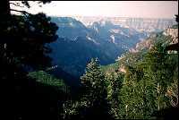
Head of Bright Angel Canyon from Ken Patrick Trail
|
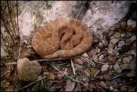
Grand Canyon pink rattlesnake taking a nap
|
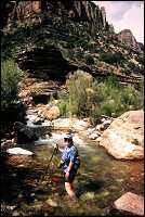
Bright Angel Creek just below confluence with Roaring Springs
|
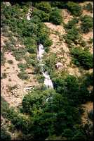
Roaring Springs from North Kaibab Trail
|
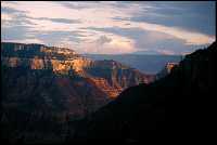
Fading light on the north rim from the top of the North Kaibab Trail
|
|